


Voting District 1052482000001, Mason County, Michigan
About
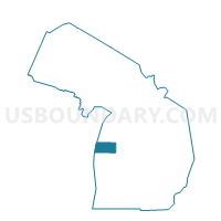
Outline

Summary
| Unique Area Identifier | 598201 |
| Name | Voting District 1052482000001 |
| County | Mason County |
| State | Michigan |
| Area (square miles) | 35.86 |
| Land Area (square miles) | 35.41 |
| Water Area (square miles) | 0.45 |
| % of Land Area | 98.73 |
| % of Water Area | 1.27 |
| Latitude of the Internal Point | 43.86197270 |
| Longtitude of the Internal Point | -86.23042710 |
Maps


Graphs
Select a template below for downloading or customizing gragh for Voting District 1052482000001, Mason County, Michigan


Neighbors
Neighoring Voting District (by Name) Neighboring Voting District on the Map
- Voting District 1051002000001, Mason County, MI
- Voting District 1051944000001, Mason County, MI
- Voting District 1054914000001, Mason County, MI
- Voting District 1056886000001, Mason County, MI
- Voting District 1271718000001, Oceana County, MI
- Voting District 1271910000001, Oceana County, MI
Top 10 Neighboring County Subdivision (by Population) Neighboring County Subdivision on the Map
- Branch township, Mason County, MI (1,328)
- Custer township, Mason County, MI (1,254)
- Riverton township, Mason County, MI (1,153)
- Crystal township, Oceana County, MI (838)
- Eden township, Mason County, MI (582)
- Colfax township, Oceana County, MI (462)
- Logan township, Mason County, MI (312)
Top 10 Neighboring Unified School District (by Population) Neighboring Unified School District on the Map
- Hart Public School District, MI (7,899)
- Mason County Central Schools, MI (7,804)
- Mason County Eastern Schools, MI (3,851)
- Walkerville Rural Community School District, MI (1,561)
Top 10 Neighboring State Legislative District Lower Chamber (by Population) Neighboring State Legislative District Lower Chamber on the Map
Top 10 Neighboring State Legislative District Upper Chamber (by Population) Neighboring State Legislative District Upper Chamber on the Map
Top 10 Neighboring 111th Congressional District (by Population) Neighboring 111th Congressional District on the Map
Top 10 Neighboring Census Tract (by Population) Neighboring Census Tract on the Map
- Census Tract 9506, Mason County, MI (4,969)
- Census Tract 105, Oceana County, MI (3,162)
- Census Tract 9507, Mason County, MI (3,139)
- Census Tract 9508, Mason County, MI (2,748)
Top 10 Neighboring 5-Digit ZIP Code Tabulation Area (by Population) Neighboring 5-Digit ZIP Code Tabulation Area on the Map
- 49420, MI (6,420)
- 49454, MI (4,574)
- 49449, MI (2,675)
- 49405, MI (1,559)
- 49402, MI (1,380)
- 49459, MI (1,351)